River and Tributaries A-Z
Explore the Wonders of Rivers and Tributaries
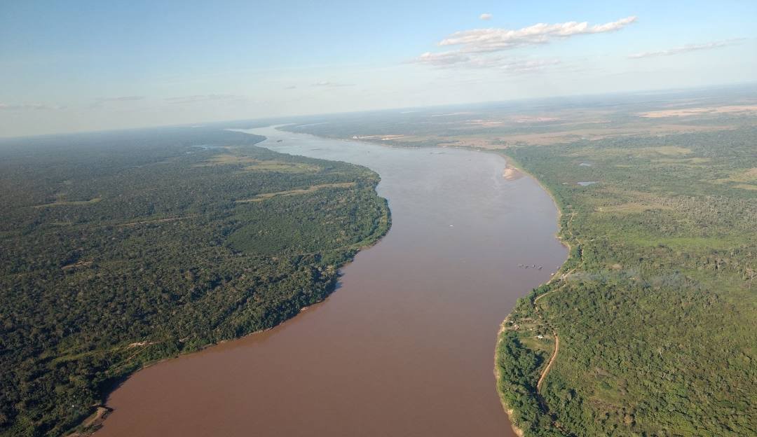
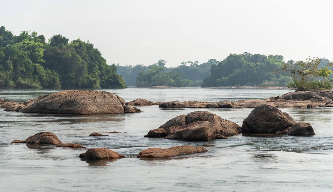
The Amazon river flows from headwaters in the towering Andes, crosses vast rainforests, meanders through the lowlands of Brazil, empties into a massive delta, and then joins the Atlantic Ocean. It traverses lands so vast and remote that measuring its length has proved a formidable task. Along the river’s route some thirteen major tributaries carry the waters of Amazonia into its path, creating South America’s greatest river and by many accounts the longest river in the world:
The Amazon has over 1,100 tributaries, 17 of which are over 1,500 kilometres (930 mi) long. Here is a list of the more notable ones.
6,259.2 km (3,889.3 mi) to 6,712 km (4,171 mi) – Amazon, South America
3,250 km (2,020 mi) – Madeira, Bolivia/Brazil
3,211 km (1,995 mi) – Purús, Peru/Brazil
2,820 km (1,750 mi) – Japura, Colombia/Brazil
2,639 km (1,640 mi) – Tocantins, Brazil
2,627 km (1,632 mi) – Araguaia, Brazil (tributary of Tocantins)
2,400 km (1,500 mi) – Juruá, Peru/Brazil
2,250 km (1,400 mi) – Rio Negro, Brazil/Venezuela/Colombia
1,992 km (1,238 mi) – Tapajós, Brazil
1,979 km (1,230 mi) – Xingu, Brazil
1,900 km (1,200 mi) – Ucayali River, Peru
1,749 km (1,087 mi) – Guaporé, Brazil/Bolivia (tributary of Madeira)
1,575 km (979 mi) – Içá (Putumayo), South America
1,415 km (879 mi) – Marañón, Peru
1,370 km (850 mi) – Teles Pires, Brazil (tributary of Tapajós)
1,300 km (810 mi) – Iriri, Brazil (tributary of Xingu)
1,240 km (770 mi) – Juruena, Brazil (tributary of Tapajós)
1,130 km (700 mi) – Madre de Dios, Peru/Bolivia (tributary of Madeira)
1,100 km (680 mi) – Huallaga, Peru (tributary of Marañón)
1,050 km (652 mi) – Rio Jutai Brazil (Amazonas)
760 km (472 mil) –Trombetas Para Brazil
1,184 km (736 mi) – Javary Brazil/Peru Amazonas
500 km (311 mi) – Jandiatuba Brazil Amazonas
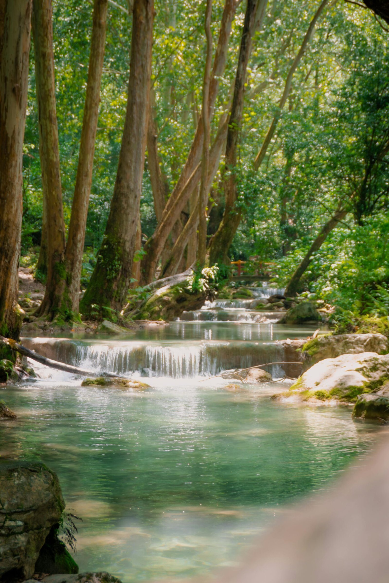
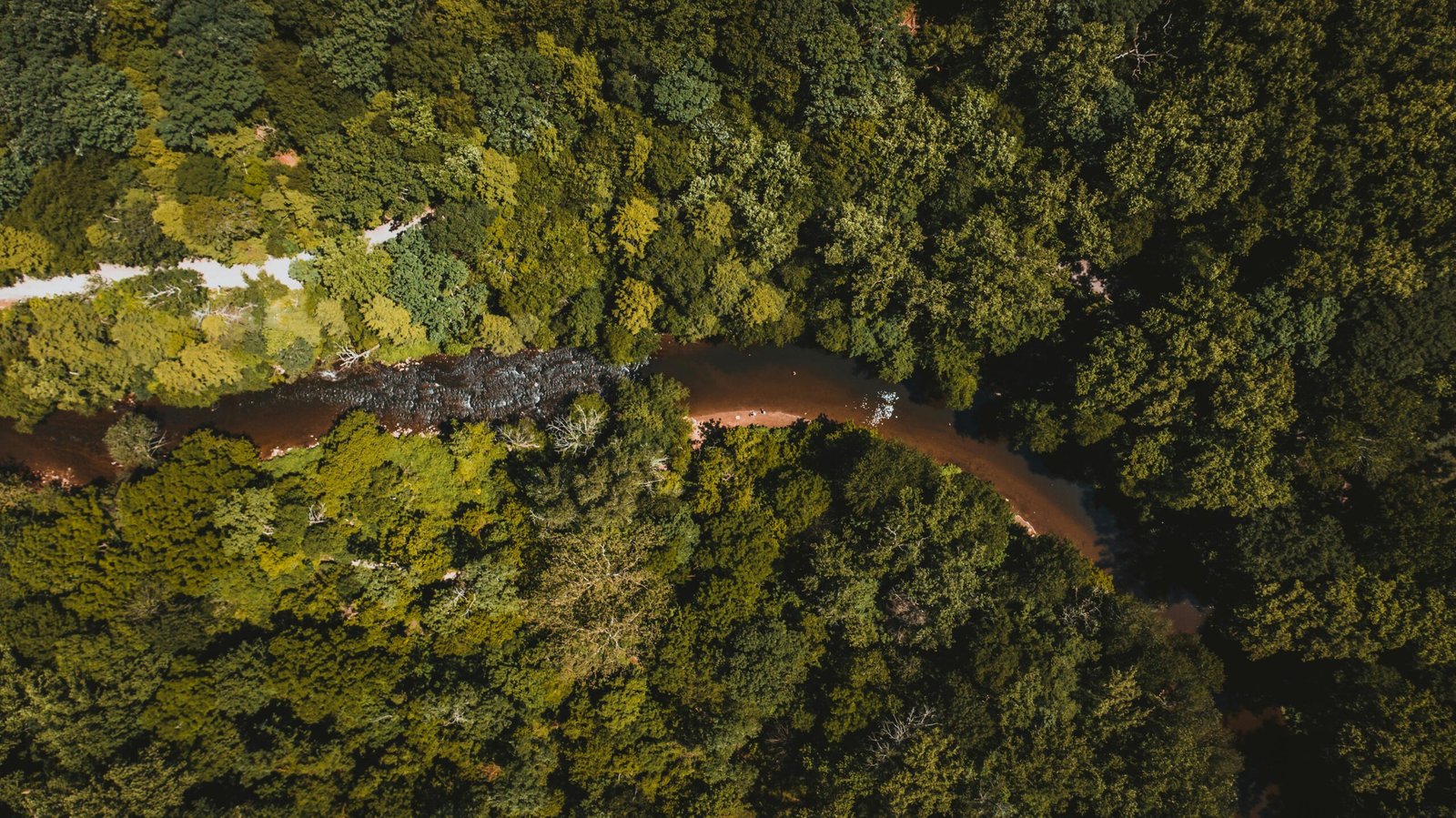
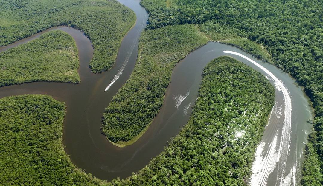
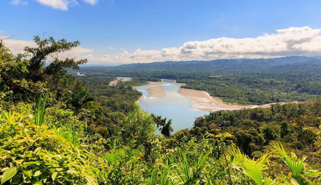
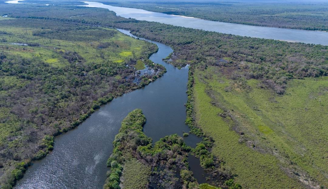
Rivers flowing over gently sloping ground begin to curve back and forth across the landscape. These are called meandering rivers.
Meandering rivers sediment from the outer curve of each meander bend and deposit it on an inner curve further down stream. This causes individual meanders to grow larger and larger.
Meandering river channels are asymmetrical. The deepest part of the channel is on the outside of each bend. The water flows faster in these deeper sections and erodes material from the river bank. The water flows more slowly in the shallow areas near the inside of each bend. The slower water can’t carry as much sediment and deposits its load on a series of point bars.
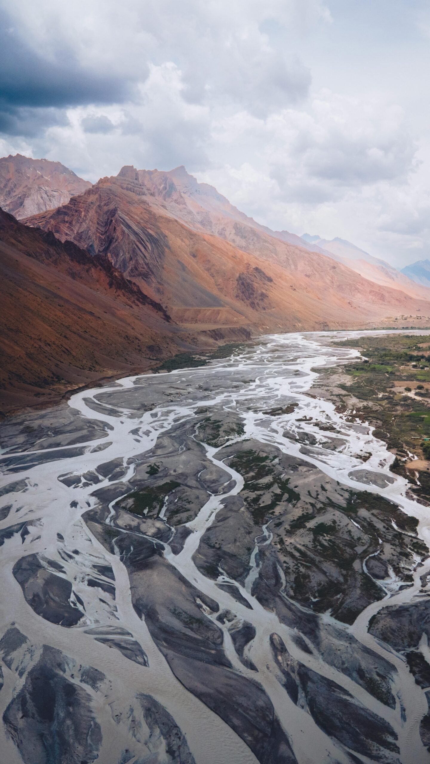
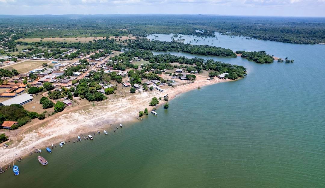
A tributary or affluent is a stream or river that flows into a main stem (or parent) river or a lake. A tributary does not flow directly into a sea or ocean. Tributaries and the main stem river serve to drain the surrounding drainage basin of its surface water and groundwater leading the water out into an ocean.
What are Oxbow lakes?
Oxbow lakes form when a meander grows so big and loopy that two bends of the river join together. Once the meander bends join, the flow of water reduces and sediment begins to build up. Over time oxbow lakes will fill with sediment and can even disappear. The point where the two bends intersect is called a mean.
What is a floodplain?
The low-lying area on either side of a river is called a floodplain. The floodplain is covered with water when the river overflows it banks during spring floods or periods of heavy rain. Sediment is deposited on the floodplain each time the river floods. Mud deposited on the floodplain can make the soil really good for agriculture.
Amazon River
The Amazon River (US: /ˈæməzɒn/; Portuguese: rio Amazonas, Spanish: río Amazonas) in South America is the largest river by discharge volume of water in the world, and the longest or second-longest river system in the world, a title which is disputed with the Nile.The headwaters of the Apurímac River on Nevado Mismi had been considered, for nearly a century, the Amazon basin’s most distant source until a 2014 study found it to be the headwaters of the Mantaro River on the Cordillera Rumi Cruz in Peru.[28] The Mantaro and Apurímac rivers join, and with other tributaries form the Ucayali River, which in turn meets the Marañón River upstream of Iquitos, Peru, forming what countries other than Brazil consider to be the main stem of the Amazon. Brazilians call this section the Solimões River above its confluence with the Rio Negro[29] forming what Brazilians call the Amazon at the Meeting of Waters (Portuguese: Encontro das Águas) at Manaus, the largest city on the river.The Amazon River has an average discharge of about 215,000–230,000 m3/s (7,600,000–8,100,000 cu ft/s)—approximately 6,591–7,570 km3 (1,581–1,816 cu mi) per year, greater than the next seven largest independent rivers combined. Two of the top ten rivers by discharge are tributaries of the Amazon river. The Amazon represents 20% of the global riverine discharge into oceans.[30] The Amazon basin is the largest drainage basin in the world, with an area of approximately 7,000,000 km2 (2,700,000 sq mi).[5] The portion of the river’s drainage basin in Brazil alone is larger than any other river’s basin. The Amazon enters Brazil with only one-fifth of the flow it finally discharges into the Atlantic Ocean, yet already has a greater flow at this point than the discharge of any other river in the world.[31][32] It has a recognized length of 6,400 km (4,000 miles) but according to some reports its length varies from 6,575–7,062 km (4,086–4,388 mi).
Madeira River
The Madeira River (Portuguese: Rio Madeira [maˈdejɾɐ]) is a major waterway in South America. It is estimated to be 1,450 km (900 mi) in length, while the Madeira-Mamoré is estimated near 3,250 km (2,020 mi) or 3,380 km (2,100 mi) in length depending on the measuring party and their methods. The Madeira is the biggest tributary of the Amazon, accounting for about 15% of the water in the basin.[5] A map from Emanuel Bowen in 1747, held by the David Rumsey Map Collection, refers to the Madeira by the pre-colonial, indigenous name Cuyari.
The River of Cuyari, called by the Portuguese Madeira or the Wood River, is formed by two great rivers, which join near its mouth. It was by this River, that the Nation of Topinambes passed into the River Amazon.
Marañón River
The Marañón River (Spanish: Río Marañón, IPA: [ˈri.o maɾaˈɲon], Quechua: Awriq mayu) is the principal or mainstem source of the Amazon River, arising about 160 km (100 miles) to the northeast of Lima, Peru, and flowing northwest across plateaus 3,650 m (12,000 feet) high, it runs through a deeply eroded Andean valley, along the eastern base of the Cordillera of the Andes, as far as 5° 36′ southern latitude; from where it makes a great bend to the northeast, and cuts through the jungle Ande in its midcourse, until at the Pongo de Manseriche it flows into the flat Amazon basin.[5] Although historically, the term “Marañón River” often was applied to the river all the way to the Atlantic Ocean, nowadays the Marañón River is generally thought to end at the confluence with the Ucayali River, after which most cartographers label the ensuing waterway the Amazon River.
As the Marañón passes through high jungle in its midcourse, it is marked by a series of unnavigable rapids and falls.
The Marañón was the subject of a landmark legal ruling related to the rights of nature. In March 2024, a Peruvian court ruled that the river itself has fundamental rights, including the right to ecological flows and to be free from pollution.
Tapajós
The Tapajós (Portuguese: Rio Tapajós [ˈʁi.u tɐpɐˈʒɔs]) is a river in Brazil. It runs through the Amazon Rainforest and is a major tributary of the Amazon River. When combined with the Juruena River, the Tapajós is approximately 2,080 km (1,290 mi) long.Prior to a drastic increase in illegal gold mining and consequent soil erosion it was one of the largest clearwater rivers and currently is an anthropogenic whitewater river, accounting for about 6% of the water in the Amazon basin.
Purus River
The Purus River (Portuguese: Rio Purus; Spanish: Río Purús) is a tributary of the Amazon River in South America. Its drainage basin is 371,042 km2 (143,260 sq mi), and the mean annual discharge is 11,207 m3/s (395,800 cu ft/s). The river shares its name with the Alto Purús National Park and the Purús Province (and its conformed Purús District), one of the four provinces of Peru in the Ucayali Region.
Huallaga River
The Huallaga River is a tributary of the Marañón River, part of the Amazon Basin. Old names for this river include Guallaga and Rio de los Motilones. The Huallaga is born on the slopes of the Andes in central Peru and joins the Marañón before the latter reaches the Ucayali River to form the Amazon. Its main affluents are the Monzón, Mayo, Biabo, Abiseo and Tocache rivers. Coca is grown in most of those valleys, which are also exposed to periodic floods.
Madre de Dios River
The Madre de Dios River (Spanish pronunciation: [ˈmaðɾe ðe ðjos]) is a river shared by Bolivia and Peru which is homonymous to the Peruvian region it runs through. On Bolivian territory, it receives the Beni River, close to the town of Riberalta, which later joins with the Mamore River to become the Madeira River after the confluence. The Madeira is a tributary to the Amazon River.
The Madre de Dios is an important waterway for the department of Madre de Dios, particularly Puerto Maldonado, the largest town in the area, and the capital of the department. Mango farming and gold mining are among the many industries on its banks. Other important industries the Madre de Dios provides are selective logging and farming, both of which are serious environmental problems. Along the length of the river, there are several national parks and reserves, notably Tambopata-Candamo National Park, Manu National Park (also known as Manu Biosphere Reserve) and Bahuaja-Sonene National Park.
juruena river
The Juruena River (Portuguese: Rio Juruena) is a 1,240 km (770 mi) long river in west-central Brazil, in the state of Mato Grosso.The Juruena originates in the Parecis plateau.[5] Within Mato Grosso the river defines the eastern boundary of the 227,817 hectares (562,950 acres) Igarapés do Juruena State Park, created in 2002. For the last 190 km (120 mi) of its lower part the river becomes the border between the states Mato Grosso and Amazonas.In this section the river forms the boundary between the Sucunduri State Park to the west in Amazonas and the Juruena National Park to the east in Mato Grosso. In the north of this section it forms the boundary between the Bararati Sustainable Development Reserve in Amazonas and the Apiacás Ecological Reserve in Mato Grosso.The Juruena finally joins the Teles Pires river to form the Tapajós river, which is one of the biggest tributaries to the Amazon River. The Juruena River is not fully navigable due to its many waterfalls and rapids. The river is known for the Salto Augusto Falls.
Xingu River
The Xingu River (/ʃɪŋˈɡuː/, shing-GOO; Portuguese: Rio Xingu [ˈʁi.u ʃĩˈɡu]; Mẽbêngôkre: Byti [bɯˈti]: 73 ) is a 1,640 km (1,020 mi)[1] river in north Brazil. It is a southeast tributary of the Amazon River and one of the largest clearwater rivers in the Amazon basin,accounting for about 5% of its waterThe first Indigenous Park in Brazil was created in the river basin by the Brazilian government in the early 1960s. This park marks the first indigenous territory recognized by the Brazilian government and it was the world’s largest indigenous preserve on the date of its creation. Currently, fourteen tribes live within Xingu Indigenous Park, surviving on natural resources and extracting from the river most of what they need for food and water.The Brazilian government built the Belo Monte Dam on the Lower Xingu, which began operations in 2019 and is the world’s fifth-largest hydroelectric dam. Construction of this dam was under legal challenge by environment and indigenous groups, who assert the dam would have negative environmental and social impacts along with reducing the flow by up to 80% along a 100 km (60 mi) stretch known as the Volta Grande (“Big Bend”).[9] The river flow in this stretch is highly complex and includes major sections of rapids.[10] More than 450 fish species have been documented in the Xingu River Basin and it is estimated that the total is around 600 fish species, including many endemics.[11] At least 193 fish species living in rapids are known from the lower Xingu,[10] and at least 26 of these are endemic.[12] From 2008 to 2018 alone, 24 new fish species have been described from the river.Many species are seriously threatened by the dam, which will significantly alter the flow in the Volta Grande rapids.In the Upper Xingu region was a highly self-organized pre-Columbian anthropogenic landscape, including deposits of fertile agricultural terra preta, black soil in Portuguese, with a network of roads and polities each of which covered about 250 square kilometers.Near the source of Xingu River is Culuene River, a 600 kilometres (370 mi) tributary.